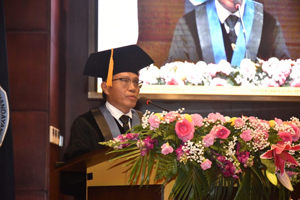
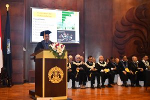
The Chancellor of the University of Indonesia (UI), Prof. Dr. Ir. Heri Hermansyah, S.T., M.Eng., IPU, inaugurated Prof. Dr. Drs. Supriatna, M.T., Geog.PU. as a Permanent Professor of the Faculty of Mathematics and Natural Sciences (FMIPA) UI, on Wednesday (15/1), at the UI Depok Campus Convention Hall. Prof. Supriatna was inaugurated as a Professor of Land Use Spatial Modeling and is the 7th professor inaugurated this year out of a total of 481 UI professors.
At his inauguration, Prof. Supriatna delivered a speech on “Spatial Modeling for Sustainable Development”, which reviewed the role of spatial modeling to support development in all fields. According to him, Geography, especially spatial modeling, can provide research results that are holistic, multi, and interdisciplinary, so that this science is very relevant to the progress of the times.
"Geography is multidisciplinary in nature, encompassing various disciplines, both natural sciences and social sciences, so that geography is the mother of all sciences. Geography as a science that studies spatiality (space) plays a major role in the development process. transdisciplinary for sustainable development," said Prof. Supriatna.
In studying space, spatial models are important tools to explore the drivers of land use, support urban planning and policy making, and assess ecological impacts. Spatial modeling is one of the techniques often applied to study land cover dynamics. Unfortunately, although it has been widely applied, the use of spatial modeling has not been maximized.
According to Prof. Supriatna, increasing urbanization and population growth have made changes in land cover and land use increasingly significant. This causes environmental problems, such as lack of agricultural land and loss of biodiversity that affect sustainable development. Therefore, monitoring land cover changes is important to reveal the dynamics of global land change, climate change, land systems and ecosystem sustainability, and to predict the future.
Spatial modeling, especially Spatial Dynamics, is becoming an important tool in predicting changes and helping in more effective spatial planning. By combining Geographic Information Systems (GIS) and dynamic systems, these models provide innovative solutions to maintain the balance between human needs and environmental sustainability. Some models have even been developed that include salinity algorithms for waters estuary, modeling of coastline changes, to detection of natural resources such as hydrocarbons and geothermal.
His research includes land carrying capacity models that assess the balance between population growth, regional development, and natural resource availability. His research includes coastline changes, marine resource potential, and the impacts of climate change. One of his innovative contributions is the Cimandiri Algorithm used to determine estuary boundaries using salinity data from satellite imagery.
Currently, Prof. Supriatna is leading research to map solar energy potential using UAVs (drone) and modeling crop productivity through spatial analysis. In the future, spatial modeling research will focus on renewable energy, plant health, and sustainable land use. Technology drone and satellite sensors are further expanding the scope of this research, strengthening the role of geography as a science that contributes directly to sustainable development.
"With all its potential, spatial modeling is ready to answer the challenges of the times, creating data-based solutions for harmonious development between humans and nature. Research in this field will continue to drive innovation for a better future," he said.
Prof. Supriatna's research on spatial modeling shows his expertise in the field. His latest research results have been published in the Scopus Q2 indexed International Journal on December 16, 2024, entitled "Spatial Phenology and Rice Productivity Estimation Based on Vegetation Indices in Wargasetra Village Using Planet Fusion Satellite Imagery". Previously, he was recorded as producing 30 international articles in reputable journals; 30 national articles in Sinta indexed journals; 110 indexed international proceedings articles; 39 international, national, and local (UI) research grants; 14 Community Service grants; 12 Teaching and Popular Books; 15 Intellectual Property Rights and 1 patent; and 5 journals as Bestari Partners/Reviewers/Editors.
Before being inaugurated as a professor, he completed his Bachelor of Science, Geography Department, FMIPA UI in 1992; Master of Engineering, Geodesy Department, Faculty of Civil Engineering and Planning, Bandung Institute of Technology in 1998; and Doctor of Environmental Science, Environmental Science Study Program, UI in 2016. Currently, he serves as Head of the Geography Department, FMIPA UI and Head of the Center for Applied Geography Studies (PPGT) of the Special Work Unit of the Applied Science Institute, FMIPA UI.
The inauguration ceremony of Prof. Supriatna was also attended by invited guests, including the Deputy for Geophysics of the Meteorology, Climatology, and Geophysics Agency (BMKG), Dr. Nelly Florida Riama, M.Sc.; Deputy for Empowerment of Disadvantaged and Certain Village Communities of the Coordinating Ministry for Community Empowerment, Prof. Dr. rer. nat. Abdul Haris, M.Sc.; Director General of Land Acquisition and Land Development of the Ministry of ATR/BPN, Ir. Embun Sari, M.Sc.; Member of the West Java Provincial DPRD, H. Pradi Supriatna, S.Kom., M.M.S.I.; Elected Mayor of Sukabumi, H. Ayep Zaki; Elected Deputy Mayor of Depok, Chandra Rahmansyah, S.Kom, M.TI.; Elected Deputy Mayor of Sukabumi, Bobby Maulana; and Deputy Director of Topography of the Indonesian Army, Colonel (CTP) Ir. Supriyadi Amperanto, S.Si.