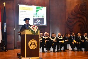
The FMIPA UI Community Service Team led by Dr. Rokhmatuloh, M.Eng. is currently carrying out community service activities in Kalibaru Village, North Jakarta.
This activity is carried out over a period of 8 months, starting in June and ending in November.
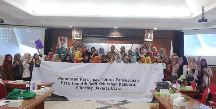
During this period, Rokhmatuloh and the team attempted to complete the activity themed Utilization of Geographic Information System (GIS) & Remote Sensing (PJ) Technology with Participatory Methods for Compiling Detailed Thematic Maps in Kalibaru Village, Cilincing District, North Jakarta.
The main partners involved in this activity are the Kalibaru Sub-district Dasawisma officers.
The main partners involved in this activity are the Kalibaru Sub-district Dasawisma officers.
According to him, the recap of data collection from dasawisma officers, whether done manually or based on applications, has so far only been presented in the form of tabular statistical data or graphic info.
Thus, through this program, Rokhmatuloh and his team trained the dasawisma officers to be able to utilize the role of information systems that are oriented towards references on the earth's surface or spatially, as a basis for decision making for planning and operationalization.
Dasawisma officers are the smallest organ of the Family Welfare Empowerment (PKK) which has the formal task of conducting detailed data collection on the condition of the community per housing unit.
Rokhmatuloh, who currently serves as the deputy dean for field II of FMIPA UI, explained that one dasawisma officer oversees ten housing units.
The workshop activity was the beginning of a series of programs. Taking place in the Kalibaru Village Hall (10/7), attended by representatives of RW dasawisma officers, village staff and PKK administrators, the service team simulated the use of remote sensing data (drone photos) that can be done by dasawisma officers.
The result is that the dasawisma officers are able to create maps of RT boundaries and the distribution of dasawisma in Kalibaru Village.
Monday (5/8) still in the same place, the team held participatory mapping training to compile detailed thematic maps as a continuation of the workshop activities.
This training involved 50 participants consisting of dasawisma officers, RW representatives, PKK administrators and village staff.
Based on tabular data collected by dasawisma officers, participants are trained to have skills in simple spatial data processing.
The output of this stage, partners can obtain information on environmental conditions spatially from maps that have been produced by utilizing Geospatial Information Systems (GIS) Technology.
The GIS application was created using QGIS software (open source) which is designed in such a way that it is easy for users to operate.
Participants are given one month since the training activity to participatively input data on events/conditions in their respective areas of duty. Furthermore, the results of the updates carried out by the participants will be socialized in the second workshop activity in September.
Participants are given one month since the training activity to participate in input data on events/conditions in their respective areas of duty. Furthermore, the results of the updates carried out by the participants will be socialized in the second workshop activity in September.
In an effort to maintain the sustainability of the program, since the beginning of the activity, the team has involved the village, namely Suyono as the Head of Kalibaru. In this case, Suyono also provided great support by assigning village staff as operators who update the map.
In the future, the community service program by FMIPA UI will end by providing optimal, sustainable benefits and increasing environmental insight for residents in general, especially for dasawisma officers.
News source: https://sci.ui.ac.id/