Refreshment Course Held Online to Improve Understanding of Maps and Spatial Analysis for Medical Personnel and Health Administration in Depok City
February 21, 2025
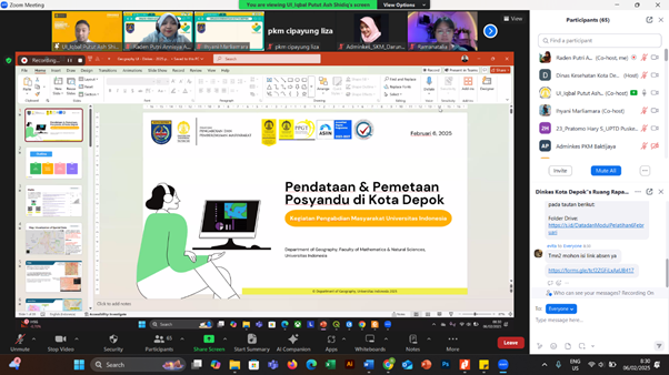
Online mapping training for administrative staff at the Depok City Health Center and Depok City Health Office on Thursday (06/02)
After successfully submitting the results of community service in the form of a Map of the Distribution of Ambulance Service Points in Depok City, the Community Service Team from the Department of Geography, FMIPA UI was again invited to hold a refreshment course in the form of online mapping training. The training was conducted to improve understanding of map making and spatial analysis for medical personnel, health center admins, and City Health Office staff. This activity is a continuation of the community service program that has been carried out previously, where the team provided training to each health center in Depok City to collect, create, and present maps using applications such as Google Photos, My Maps, and Story Maps.
Previous training focused on data collection using geotagged photos and internet-based map creation. This time, the activities refreshment course conducted online to deepen participants' understanding in analyzing spatial data and utilizing it to support health services in Depok City. This training is expected to increase the capacity of medical personnel and health administrators in managing spatial data, so that it can be used for more effective planning and decision making.
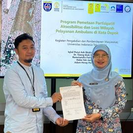
Activity refreshment course This is a follow-up to the handover of the results of community service funded by the University of Indonesia through the Directorate of Community Service and Empowerment (DPPM) which has now changed its name to the Directorate of Community Service and Social Innovation (DPIS) to the Depok City Health Office. In the handover, the results of community service in the form of an ambulance service map and a map of the distribution of integrated health posts, were received directly by the Head of the Depok City Health Office, dr. Mary Liziawati. In her remarks during the handover, dr. Mary expressed her high appreciation for the contribution of the UI Geography Community Service Team. "The maps that were handed over are very useful for us in improving health services, especially in terms of ambulance distribution. We hope that collaboration like this can continue to advance health services in Depok City," she said.
The UI Geography Community Service Team officially submitted the Map of the Distribution of Ambulance Transport Service Points in Depok City to the Depok City Health Service (24/01)
In refreshment course This time, participants were invited to review previous materials and learn new techniques in spatial analysis. The UI Geography Community Service Team, assisted by Ramanatalia Parhusip, S.Si. as the training instructor, provided practical guidance on how to update data independently using the previously introduced applications. "We want to ensure that participants not only understand the theory, but are also able to apply it independently in their daily work," explained Iqbal Putut Ash Shidiq, M.Sc., Ph.D., as the training facilitator and head of the UI FMIPA Geography community service team.
This activity was attended by dozens of participants from various health centers and the Depok City Health Office. The participants were enthusiastic in following the training session, which was designed interactively with discussions and questions and answers. "This training really helps us understand how to use technology to support health services. We hope to be able to apply it directly in the field," said one of the participants.
Group photo of training facilitators, instructors, and student representatives of the UI Geography Community Service Team, as well as participants of the online refreshment training. (06/02)
With the activities refreshment course This, it is expected that medical personnel and health administrators in Depok City can become more proficient in managing spatial data, so that they are able to provide more responsive and integrated health services. The UI Geography Community Service Team is committed to continuing to support the improvement of human resource capacity in the health sector through geospatial-based innovation.
About the UI Geography Community Service Team:
The FMIPA UI Geography Community Service Team is a group of students and lecturers who focus on geospatial-based research and community service activities. Their activities aim to provide real solutions to community problems through a geographic approach and mapping technology.
Depok, 25 Juni 2025. Indonesia, sebagai rumah bagi keanekaragaman hayati global yang luar biasa, menghadapi tantangan besar akibat alih fungsi lahan dan kebakaran hutan. Namun, Prof. Dr. Rokhmatuloh., S.Si., M.Eng.,
Depok, 25 Juni 2025. Sumber daya perikanan Indonesia berperan penting dalam ketahanan pangan, pendapatan, dan mata pencaharian, serta menjadi sumber protein hewani yang terjangkau bagi masyarakat miskin di pedesaan. Hal
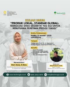
“Local Products with Global Standards: TGS EQ1 Geodetic GNSS Technology for High Precision Mapping Needs” This event will be held on:Day/Date: Wednesday, March 12, 2025Time: 13.00 – 15.00 WIBVenue: