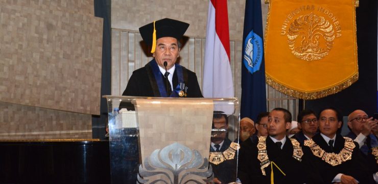
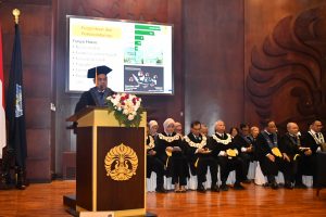
Prof. Dr. Muhammad Dimyati, M.Sc., was inaugurated as a Permanent Professor in the field of Remote Sensing and Environmental Sciences, Faculty of Mathematics and Natural Sciences, University of Indonesia (FMIPA UI) on Wednesday (26/7/2023) at the Makara Art Center, UI Depok Campus. In front of the guests, Prof. Dimyati delivered his scientific oration entitled "Efficient Land Use and Land Cover Monitoring Model in Indonesia Based on Remote Sensing Data". The inauguration ceremony was led directly by the Chancellor of UI, Prof. Ari Kuncoro, S.E., M.A., Ph.D., and broadcast virtually through the YouTube channels of the University of Indonesia and UI Teve.
In his oration, Prof. Dimyati said that remote sensing satellite data is increasingly varied, both in spatial, spectral, temporal and radiometric resolution. The accessibility of remote sensing data by the public is also increasing, both due to its ease and availability. The development of software and hardware to process remote sensing data into Land Use and Land Cover Change (PLTL) information is increasingly sophisticated, along with the development of the industrial revolution 4.0. Regulations and mechanisms that support public convenience in accessing spatial data and information, such as thematic spatial information and spatial planning information have increasingly placed the public in the spatial planning process.
In addition, the available regulations have also allowed parties, including the private sector, to be involved in the process of preparing spatial plans in a participatory manner, without abandoning the principles of appropriate quality and timeliness. The development of this ecosystem has also been welcomed by the public with various participation efforts, such as participatory mapping of land use and land cover.
Therefore, guidelines for making maps and monitoring land use and land cover that are efficient and accessible to the public are important. The goal of making these maps is to return to improving public services. Prof. Dimyati conducted research to compile an efficient PLTL Monitoring model in Indonesia based on remote sensing data. The research began when Prof. Dimyati graduated from Gadjah Mada University, worked at the Ministry of Public Works and continued to tread the path until Prof. Prof. Dimyati is a lecturer in the Department of Geography, FMIPA UI. The use of the PLTL model developed and initiated by Prof. Dimyati and his team, starting from the use of conventional digital techniques of clustering, principal component analysis, and also maximum likelihood to the most advanced, and especially those developed by utilizing GeoAI on the GEE cloud computing platform and supported by the development of ChatGPT.
This is believed and proven to increase efficiency will have good development prospects. This development further increases the availability of the most recent PLTL data (up to date) to support monitoring of regional spatial planning and other spatial data analysis needs. This will further improve the quality and time of public services, including licensing and investment climate. As a lecturer and researcher, Prof. Dimyati hopes that the improvement of the research ecosystem in supporting the implementation of the PLTL monitoring model by utilizing GeoAI and ChatGPT support can be one of the recommended choices for institutions that have the authority and duties in this field.
This is believed and proven to increase efficiency will have good development prospects. This development further increases the availability of the most recent PLTL data (up to date) to support monitoring of regional spatial planning and other spatial data analysis needs. This will further improve the quality and time of public services, including licensing and investment climate. As a lecturer and researcher, Prof. Dimyati hopes that the improvement of the research ecosystem in supporting the implementation of the PLTL monitoring model by utilizing GeoAI and ChatGPT support can be one of the recommended choices for institutions that have the authority and duties in this field.
Then, he received a Master of Agricultural Science degree from the Laboratory of Regional Planning, Tropical Agriculture Division, Faculty of Agriculture, Kyoto University in 1990. Still on the same campus, Prof. Dimyati received her Doctorate in Agricultural Science in 1997. As of June 2023, Prof. Dimyati has produced 125 scientific papers (KTI) in the form of books, journals, and proceedings and other writings. Of these KTI, 63 KTI were published in Scopus indexed journals. The rest were published in National Journals and popular digital and print media. Some of her scientific works, namely Potential Distribution of Skipjack Tuna Using MODIS Satellite Imagery in The Southern Waters
News source: https://sci.ui.ac.id/