FMIPA UI – UGK Collaborate in Inventory of Potential Natural Disasters in Gunungkidul Regency
February 16, 2024
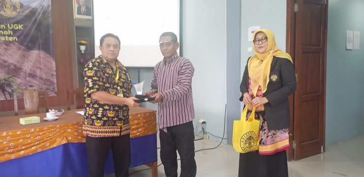
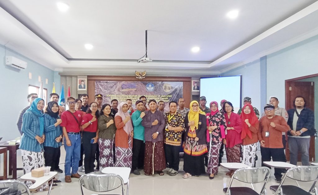
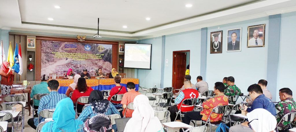
The Faculty of Mathematics and Natural Sciences, University of Indonesia (FMIPA UI) through the Department of Geography, in collaboration with the University of Gunung Kidul (UGK) carried out community service activities by disseminating the results of the "Inventory of Potential Landslide Natural Disasters in Kapanewon Gedangsari, Gunungkidul Regency", on Thursday (1/2/2024), at the Prof. Koesnadi Hardjosumantri Hall, Campus 2, Universitas Gunung Kidul.
This activity is a continuation and development of one of the FMIPA UI Research Grant activities for the 2023-2024 Fiscal Year entitled "Spatial Study of Landslide Risk in Kapanewon Gedangsari, Gunungkidul Regency, Yogyakarta" which is chaired by Adi Wibowo, M.Sc., PhD. (UI), and consists of Dra. (UI), Ir. (UGK), Sabilla Fitri Handayani, S.Sc. (UI), Maulana Eighner Daffa Jalatama (UI), Ezia Purnama Putri (UI). In addition, this activity is a continuation of the Field Work Lecture 2 of the University of Indonesia which was previously held in Gunungkidul in May 2022.
Various related parties were present at this event, including BPBD, TAGANA, Social Services, Information and Communication, BAPPEDA, Gunungkidul Resort Police, 0730 Gunungkidul Military District Command, Gunungkidul FPRB, Gunungkidul FDTB, Gunungkidul PMI, Save Rescue Gunungkidul, Gedangsari Sub-district, Gedangsari Police, and Gedangsari Military District Command.
"The Community Service Team focuses on community anticipation and adaptation efforts to natural disasters, especially landslides. We emphasize the importance of understanding residential conditions and adaptation strategies as proactive steps in dealing with natural disasters," said Adi Wibowo as the team leader.
Although the Gedangsari District community has experience in dealing with landslides, according to him, a review of government policies and early warning systems is still needed to increase disaster capacity in the area.
According to Dra. Astrid Damayanti, M.Sc., as one of the disaster mitigation efforts by the local government, a village potential book on disasters is needed. This was conveyed in response to input from discussions with stakeholders, including recommendations for pre-disaster-post-disaster mapping including the authority of each disaster management model. stakeholder, covering recommendations for pre-disaster-post-disaster mapping including the authority of each disaster management model.
"Based on the research results, basically, all villages in Gedangsari District have implemented all types of adaptation strategies with different percentages of strategy use. Villages that are superior in dealing with landslides use strong economic and social strategies such as in Serut Village and Hargomulyo Village," said Astrid.
strategies in dealing with landslides, and not just rely on themselves. In Gedangsari District, the level of capacity of the village community is quite diverse, there are villages that are classified as resilient to disasters with the highest level of community capacity being Serut Village, Hargomulyo Village, and Ngalang Village.
This is influenced by the community who are more sensitive to environmental security and their responsiveness causes an adaptation strategy that is made different from other villages so that it is easier to adapt well.
As for villages with medium and low capacity levels, namely Mertelu Village, Tegalrejo Village, Watugajah Village, and Sampang Village because they have limited environmental factors and their communities do not have adequate adaptation so that a special review is needed to increase community capacity so that the community does not only depend on themselves but works together with disaster organizations and the government.
DEPARTEMEN GEOGRAFI – Suasana berbeda menyambut kunjungan spesial dari siswa-siswi homeschooling Kak Seto ke Departemen Geografi. Kamis, 23 Oktober 2025 ruang yang biasanya dipenuhi diskusi akademik mahasiswa, kini riuh rendah
Depok, 25 Juni 2025. Indonesia, sebagai rumah bagi keanekaragaman hayati global yang luar biasa, menghadapi tantangan besar akibat alih fungsi lahan dan kebakaran hutan. Namun, Prof. Dr. Rokhmatuloh., S.Si., M.Eng.,
Depok, 25 Juni 2025. Sumber daya perikanan Indonesia berperan penting dalam ketahanan pangan, pendapatan, dan mata pencaharian, serta menjadi sumber protein hewani yang terjangkau bagi masyarakat miskin di pedesaan. Hal