Geography Department FMIPA UI Introduces GIS-Based Digital Maps in Ciracap District Village
October 30, 2020
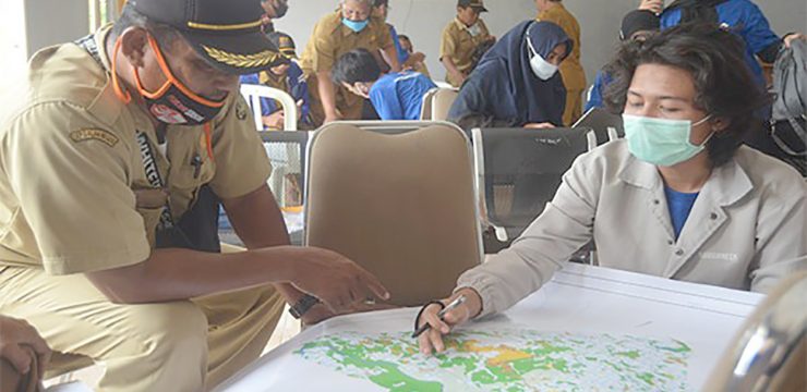
The Department of Geography, FMIPA UI, introduced digital maps based on geographic information systems as well as training in completing map information for village officials in Ciracap District, Sukabumi, West Java on Saturday (24/10).
This activity is a Community Service (Pengmas) program for digital mapping of village potential and student field work.
Dr. Supriatna, M.T. explained that village maps are important products in village government activities, because village maps are a guide and reference for national development planning with detailed information at the village level.
"The village map is a large-scale map (1:5,000), which is used as a reference for various activities related to village government. For example, mapping of regional/village boundaries, reporting various events with their locations without an internet connection," said Dr. Supriatna, M.T.
The Digital Map introduced by the community service team of the Geography Department, FMIPA UI, is a map based on Geographic Information System (GIS) technology that can be used for mapping village planning, mapping various potentials such as agricultural potential, disaster potential and so on.
With the help of GIS technology, digital maps become easy to edit (complete) and utilize. The data produced from the editing also has high accuracy.
Thus, continued the Head of the Geography Department of FMIPA UI, the potential picture of a village can be seen and identified completely and comprehensively. For example, the potential for various disasters, to the spread of Covid-19.
"The potential for landslides, flash floods and even the potential for the spread of Covid-19 can be mapped with the help of geographic information system (GIS) technology," he explained.
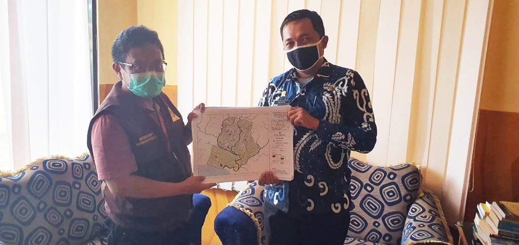
The FMIPA UI Geography Community Service Team also provided a base map in PDF format produced by village officials in this training to the village government in Ciracap District.
Maps in this format are land use maps, maps of important places (points of interest), geological maps, soil type maps, river flow maps, slope maps, elevation maps and geomorphological maps as a reference for making village potential maps.
"This base map is used as a material to create a village potential map. Specifically, land use maps and important place maps are used to draw village boundaries, village boundaries and reporting important places of events in a location can be done by village officials who have been trained in the training," he said.
Through this activity, Dr. Supriatna, M.T. and his team hope that this training and introduction to digital maps can increase understanding of the importance of making digital maps based on Geographic Information System (GIS) technology and identifying village potential by government officials in the regions.
The community service activity was carried out by complying with the Covid-19 health protocol (Prokes). The reason is, all lecturers, teaching assistants and students were given a rapid test before leaving and all were non-reactive.
DEPARTEMEN GEOGRAFI – Suasana berbeda menyambut kunjungan spesial dari siswa-siswi homeschooling Kak Seto ke Departemen Geografi. Kamis, 23 Oktober 2025 ruang yang biasanya dipenuhi diskusi akademik mahasiswa, kini riuh rendah
Depok, 25 Juni 2025. Indonesia, sebagai rumah bagi keanekaragaman hayati global yang luar biasa, menghadapi tantangan besar akibat alih fungsi lahan dan kebakaran hutan. Namun, Prof. Dr. Rokhmatuloh., S.Si., M.Eng.,
Depok, 25 Juni 2025. Sumber daya perikanan Indonesia berperan penting dalam ketahanan pangan, pendapatan, dan mata pencaharian, serta menjadi sumber protein hewani yang terjangkau bagi masyarakat miskin di pedesaan. Hal