Academics from the Department of Geography, FMIPA UI, who are members of the Community Care Team, have successfully mapped the geotourism potential in Cikarang Village, Jampangkulon District, Sukabumi Regency on. The activity was carried out from November 30 to December 1, 2021.
Mapping of geotourism potential is still a series of activities in the “PHYLLAGE” program (Geography for Village) which will be held for five days, starting from November 29 to December 4, 2021.
Team leader Septian Agung Waluyo (Geography 2019) said that one of the potentials that he and his team managed to map together with the Cikarang Village community included coordinate points and routes. trekking Curug Three in One. It is named as such because the waterfall consists of three waterfalls that meet into one. The three waterfalls are Curug Nangsi, Curug Cibenda, and Curug Cikupa.
"The location is a place that has not been managed so it needs to be developed again. Although there are many obstacles to accessing these locations, it does not reduce the spirit of the team and participants in the training," said Septian to the FMIPA UI Public Relations team.
"These results will later become the basis for creating a geotourism map of Cikarang Village with the hope of improving community welfare through the tourism sector," he said.
Another geotourism object that was successfully mapped was Curug Ciborohol which is also close to Gua Cipicung and Gua Oman. All of these objects were mapped by conducting plotting and tracking so that the coordinate point data of the object is obtained along with the route to the object. This information is very important to develop the geotourism potential in Cikarang Village.
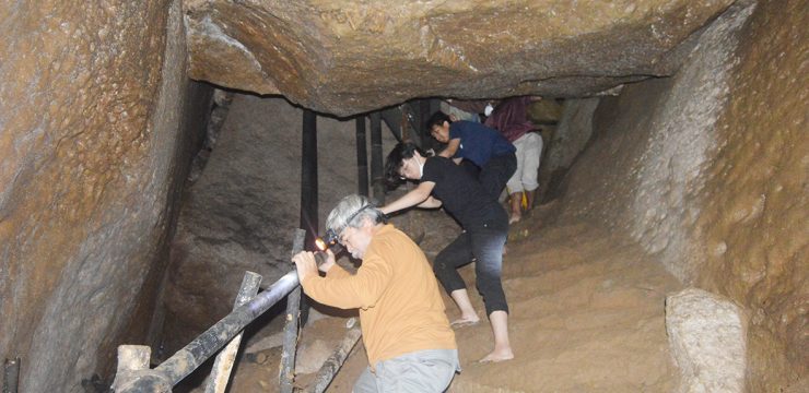
The team consisting of twelve students and one accompanying lecturer was also invited by the villagers to directly review the Baduy Cave geotourism object located in Sukamanah Village, Cimanggu District, Sukabumi Regency. This tourist attraction is in fairly good condition because it is managed independently by the community.
The team conducted a survey from the entrance to the cave to see its condition directly. Inside the team found stalactites, stalagmites, and an underground river with a fairly strong current.
"With this survey we can see examples of geotourism development that can be applied in other villages by relying on community self-reliance and local wisdom," he added.
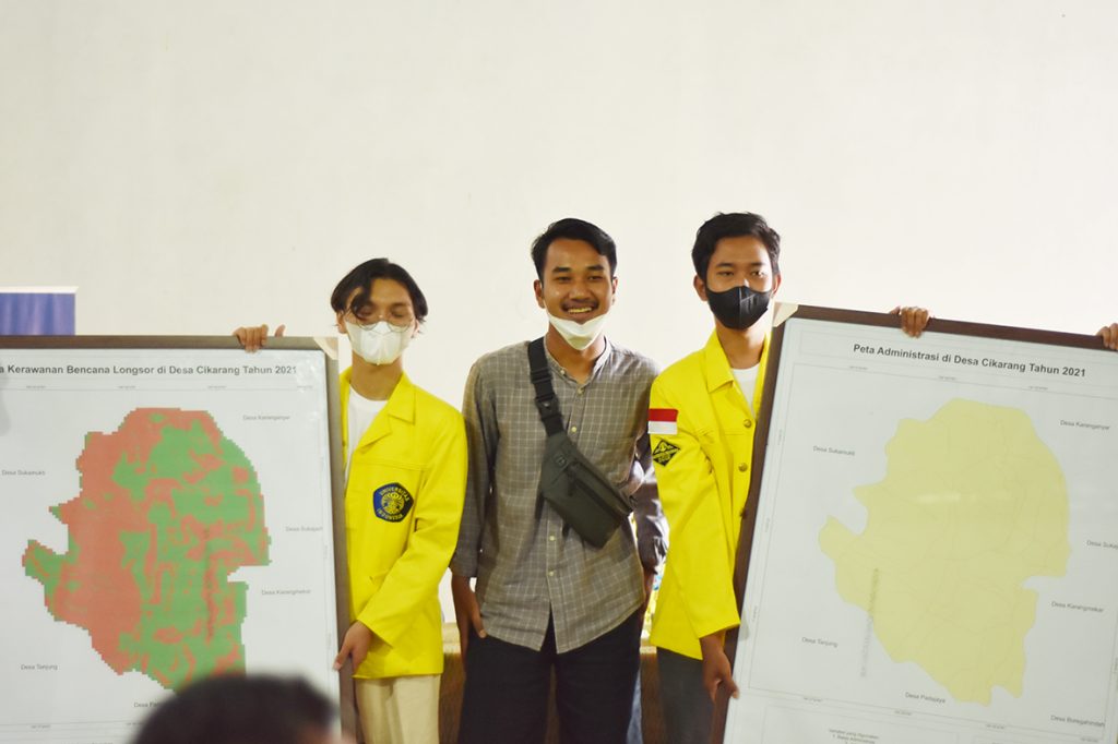
In addition to geotourism potential, this program has also succeeded in mapping the potential for landslides in Cikarang Village, Sukabumi Regency. Its hilly to steep topography causes landslides to be one of the disasters that need to be anticipated. One of the anticipatory efforts is to identify areas that have the potential for landslides so that disaster mitigation and other preventive measures can be carried out.
In this program, the team together with villagers conducted a field survey to see directly the landslide-prone areas. The team also produced a landslide-prone map in Cikarang Village which will be given to the local village apparatus.
News source: https://sci.ui.ac.id/


