Still in the series of PHYLLAGE activities (Geography for Village), the community service team of the Department of Geography, FMIPA UI, consisting of one accompanying lecturer and twelve students launched the Village Mapping Forum in Cikarang Village, Sukabumi Regency, West Java on November 30 to December 1, 2021.
Tjiong Giok Pin S.Si., M.Si as the accompanying lecturer said, "This activity is intended to encourage the independence of village communities in developing their potential in a sustainable manner.
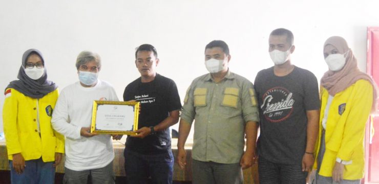
The launch of the forum which took place in the Cikarang Village Office Hall was also the closing activity for the entire series of PHYLLAGE activities (Geography for VillageSymbolically, the launch of the forum was marked by the handover of certificates by the team to village officials.
The closing was also attended by Encep Muharom, Secretary of Jampangkulon Sub-district, Asep Yudistira, S.IP, Head of Cikarang Village, UI Community Care Team (Kepmas), and several residents of Cikarang Village.
The Head of Cikarang Village expressed his appreciation to the team and hopes for the implementation of this activity.
"To the University of Indonesia, we would like to express our gratitude for this activity because it has many benefits. With this event, we can...update regional map with a focused level of accuracy (detail), especially for several potential links that can be accessed or displayed in the results of this activity mapping. The next hope, great hope can be carried out for further activities so that it can bring up innovations that are beneficial for the Cikarang Village that we love," said Asep.
On this occasion, a simple mapping module was submitted by the team to the Secretary of the Jampangkulon Sub-district Head of Cikarang Village as a written guide for residents and village officials in conducting participatory mapping.
“In general, the module contains an introduction software spatial data processing, data collection and data processing tutorials, to mapping materials and cartography principles," said team leader Septian.
Not only that, the team also submitted large administrative maps and landslide-prone maps to the Cikarang village apparatus.
The Village Mapping Forum is one part of the output of the PHYLLAGE program (Geography for Village). This program contains digital survey and mapping training activities intended for village communities so that they can carry out mapping in a participatory manner.
The training activities took place from November 29 to December 4, 2021 in Cikarang Village, Sukabumi Regency. There were several agendas in it, such as training in spatial data collection, data processing, and providing participatory mapping materials and cartographic principles. The community who participated in the series of training activities seemed very interested and enthusiastic in learning mapping.
News source: https://sci.ui.ac.id/


