PPGT
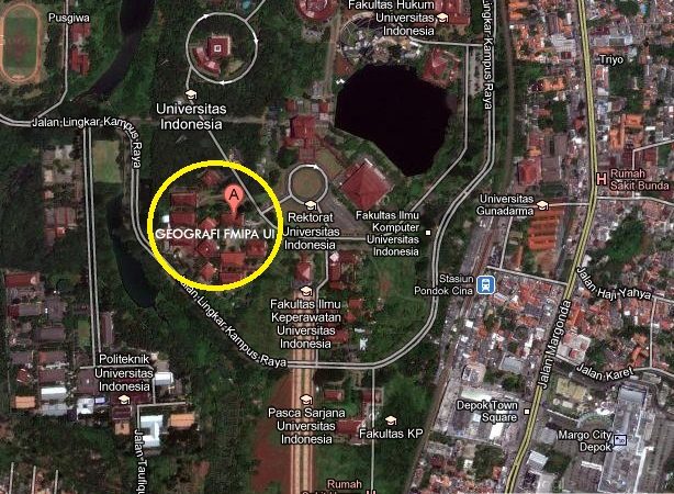
Secretariat : Departement Geography Faculty of Mathematics and Natural Science. University of Indonesia, UI Campus Depok 16424. Phone. (62-21) 7873067 Faxs. (62-21) 7873067, 7270030. Website : www.geografi.ui.ac.id
E-mail : ppgtfmipaui@yahoo.com
OBJECTIVE
- To create various regional application to support regional planning and development
- To manage experties in spatial science in order to use their knowledge of geographic science, experiences, and their capability in Geospatial Technology to support the regional development
- To upgrade the ability of research staff and lecturer of Department of Geography in geographic application research and actively participating the sustainable development, and applying geographic science and technology to the society
HISTORY
CAGR that was formed on April 11 1995 that was formed through SK the Dekan FMIPA UI No.052/PT02.H4.FMIPA/C/1989 on the 22nd March 1989 and the Meeting of the FMIPA UI Senate on 10th April 1995 as a part of the Geography Department, in the Faculty of Mathematics and Natural Sciences of the University of Indonesia.
MANAGEMENT

MANAGER : Dr. Supriatna
SECRETARY : Irma Susanti, SSi.
RESEARCH SERVICE UNIT, CONSULTATION, & PUBLICATION :
TRAINING SERVICE UNIT :
Dr. Supriatna, Drs. Triarko Nurlambang, MA, Hafid Setiadi, SSi, MT. : Adi Wibowo, SSi, MSi, Nurul Sri Rahatiningtyas, S.S, Ratri Chandra, S.Si, Revi Hernina, S.Si, MT, Andry Rustanto, S.Si, M.Sc,, Iqbal Putut A, S.Si, Kuswantoro, S.Si, Nurrokhmah Rizqihandari, S.Si, M.Si
EXPERIENCES RESEARCH :
2012 – 2011
- 2012 Web GIS Development of Barging Operation Environmental Sensitivity Index, co-operation with Conoco Phillips Indonesia, Ltd.
- Feasibility Study / Basic Design of Sunda Strait Bridge, co-operation with PT. Wiratman & Co.
- Preliminary data compilation to support the scoping mission for Climate Resilient Cities Initiative in Indonesia, co-operation with Humanitarian OpenStreetMap Team (HOT), Australia-Indonesia Facility for Disaster Reduction (AIFDR), National Board of Disaster Tackling (BNPB), World Bank’s Global Facility fro Disaster Reduction and Recovery.
- Pengolahan Data Survei Kepuasan Pegawai PT. Angkasa Pura 1 Tahun 2011, co-operation with PT. Angkasa Pura 1 – PT. Daya Makara UI
- Support for Strategic Environmental Assessment (SEA) for The Master Plan Study On Multiple-Airport Development for Greater Jakarta Metropolitan Area in The Republic of Indonesia, co-operation with Japan International Cooperation Agency (JICA)-Nippon Koei Co., Ltd.
- Indramayu Coal-Fired Power Plant Project (E/S), co-operation with Japan International Cooperation Agency (JICA) Indonesia Office.
- Soil Investigation and and Hydrological Survey Consultancy, co-operation with China Railway Engineering Corporation (M) Sdn Bhd (CRECM).
- (Additional Contract) Support for Strategic Environmental Assessment (SEA) for Master Plan Study on Port Development and Logistics in Greater Jakarta Metropolitan Area, co-operation with Japan International Cooperation Agency (JICA)-Ides Inc.
- WebGIS Environmental Sensitivity Index, co-operation with ConocoPhillips Indonesia Inc., Ltd.
- Master Plan Study On Biodiversity Conservation Center Project National Park Mountain Halimun Salak, co-operation with Sustainable Management by mean of PT. Rimbawan Bangun Lestari.
- Vulnerability Assessment and Risk Mapping Program Adaptasi Perubahan Iklim dan Pengurangan Risiko Bencana untuk Ketahanan (API Perubahan), co-operation with Mercy Corps.
- Feasibility Study on Protected Forest Region in West Sumatera, Jambi, and Riau Provinces, co-operation with CCF, SSF, WWF (World Wide Fund)
- Topograhic Survey for Coal Stock, co-operation with PT Bangun Energi Indonesia.
- Support for Strategic Environmental Assessment (SEA) for Regional Spatial Plan (RTRW) Papua – Maluku), co-operation with Ministry of Environmental RI.
- Preparation of the Programme of Protection and Management of Coastal Areas of Jakarta, co-operation with Environmental Management Agency Province of DKI Jakarta.
2010
- Preliminary Data Compilation to Support The Scoping Mission for Climate Resilient Cities Initiative in Indonesia (Case Study : Jakarta), co-operation with World Bank.
- Preliminary Data Compilation to Support The Scoping Mission for Climate Resilient Cities Initiative in Indonesia (Case Study : Yogyakarta), co-operation with World Bank
- Support for Strategic Environmental Assessment (SEA) for Master Plan Study on Port Development and Logistics in Greater Jakarta Metropolitan Area, co-operation with Japan International Cooperation Agency (JICA)-Ides Inc.
- Policy-Plan-Program Implication for Jakarta Coastal Area Structuring concerning to Flooding and Puddle (Socialization of Jakarta Coastal Area Strategic Environmental Assessment (SEA-Pantura), co-operation with Environment Office of North Jakarta.
- Support of Environmental Analysis for Spatial Planning, co-operation with Regional Development Planning Board, DKI Jakarta Province
- Forestry Permit Advisory and Procurement of its Documentation and Mapping Service Block Corridor, co-operation with ConocoPhillips (Grissik) Ltd.
- Technical Studies for Establishment Candidate City of Sofifi, North Maluku Province, co-operation with Provincial Government of North Maluku.
- Setup DVR Project Centralized Monitoring for CCTV – ATM Bank Mandiri , co-operation with Bank Mandiri – PT. Matra Lintas Net.
- KRP Implication for Jakarta Coastal Area Structuring concerning to Flooding and Puddle (Socialization of Jakarta Coastal Area Strategic Environmental Assessment (SEA-Pantura), co-operation with Environment Office of North Jakarta.
- Implementation Of Water Resource Management Policy (Ciliwung-Mookervart), co-operation with Regional Environmental Management Agency, DKI Jakarta Province.
- Support Analysis Of Spatial Planning And Environmental, co-operation with Regional Development Planning Board, DKI Jakarta Province.
- Geographic Information System (Spatial Decision Support System) Consumer In Data Analysis, co-operation with PT. Astra Honda Motor.
2009
- UKL UPL 3D Seismic Block Tuna Natuna Sea 2009, co-operation with Premier Oil Natuna Sea B.V.
- Environmental Digital Mapping Conocophillips Indonesia Inc. Ltd Block “B” AMDAL, co-operation with Conocophillips Indonesia Inc. Ltd.
- Data Verification and Simbologi Reformat Digital Map for EIA (Environment Impact Assessment) Document at Block B Jambi Selatan, and Second Phase of Tuban, co-operation with Conoco Phillips Indonesia Inc. Ltd
- Strategic Environment Assessment of Jakarta Coastal Area, co-operation with the Ministry for Environment.
- Masterplan of BMKG 2010-2030, co-operation with BMKG.
- Preliminary Data Compilation to Support The Scoping Mission for Climate Resilient Cities Initiative in Indonesia, co-operation with World Bank
2008
- Study: The Arrangement of the Public Service Retribution Policy, co-operation with the Ministry of the Empowerment of State Apparatus.
- Study of the Compilation of the policy of the Determination of the Public Service Tariff, co-operation with the Ministry of the Empowerment of State Apparatus
- Study of the Compilation of the Citizen Charter policy, co-operation with the Ministry of the Empowerment of State Apparatus
- Terra Mapping (using the Terra Model), co-operation with Conoco Phillips
- Re-measurement HGU (Leasehold for Companies) PT. BSM/ PT. LIP (including central Palm Oil Plantations PT. BSM/PT. LIP and Plasma Palm Oil Plantation) at the village of Kagungandalam, the village of Seri Tanjung in the District of Tanjung Raya, and the village of Nipah Kunning in the Mesuji District, the Regional Area of Tulang Bawang, the Province of Lampung
- Spatial Policy Development in Land Management Arrangement, co-operation with Puslitbang BPN RI
2007
- Site Investigation & Feasability Study in Lampung and West Sumatera 2 x 100 MW, co-operation with PT. PLN (Persero) Piktring SBS Palembang
- Guide for Basic Mapping ‘Penyusunan Norma Standar Prosedur dan Mekanisme (NSPM) co-operation with BPN – PT. SEWUN INDO KONSULTAN
- Survey Policy and Marine Natural Resources Mapping, co-operation with BAKOSURTANAL
- Arranging the Master Plan for Operational Development for Air Quality Monitoring 2008-2017, co-operation with the Deputy of Data Systems and Information Meteorology and Geophysics Biro – PT. Angelina Oerip Mandiri
- Study research on the Suitability of the Forming Autonomy of the City Muara Bungo, Jambi Province (2007), co-operation with the Regional Government of Bungo
- Geography Information System for Identification of City Slum Area, co-operation with Directorate of High Education, Ministry of Education and Cultural
2006
- Study and Development of Buoys, co-operation with The Natural Research and Technology Deputy for the Community and Information Empowerment and Technology
- Tsunamigenic Characteristics Study; co-operation with The Natural Research and Technology Deputy for the Community and Information Empowerment and Technology
- Study and Correlative Analysis and Spatial as well as General Selection Potential Overview/Orientation for Less Developed Regions within the PT. Exsa International’s 12 Regional areas, co-operation with PT. Exsa International
- Survey Policy and Marine Natural Resources Mapping, co-operation with BAKOSURTANAL
- Large Scale Land Authorization Rights Evaluation, co-operation with PUSLITBANG BPN
- Tracking, Mapping Measuring, Consideration and Placement of 25 Province territorial pillars, 112 Districts/Cities pillars and 15 territorial pillars, co-operation with the Government of the City of Depok and the Regional Autonomy of the City of Depok
2005
- Research: Urban Land Policy in DKI Jakarta, co-operation with BAPPEDA Province of DKI Jakarta
- Study on the Change and Model Measurement for the River Flood Plain of the Ciliwung Stream, co-operation with the Directorate of Land and Mapping Province of DKI Jakarta
- Study on the AMDAL Coastal Arrangement at Harapan Island – Kelapa Island, co-operation with the Secretariat of the Seribu Archipelago Administration
2004
- Study on the Creation of Inventory and Natural Resources Management Policy; co-operation with BAKOSURTANAL
- Urban Land Policy for the Province of DKI Jakarta, co-operation with BAPEDA of DKI Jakarta
- Study of Making Land Value Prediction in the Province of DKI Jakarta, co-operation with the Directorate of Land and Mapping DKI Jakarta
- Creating a Map of Slums in River Flood Plain in North Jakarta, co-operation with the Directorate of Land and Mapping of North Jakarta
- Human Resources Inventory on the Environment; co-operation with the Ministry for Environment
- Creating a Map for Environmental Human Resources, co-operation with Ministry for Environment
- Inventory and Evaluation Policy for Environment and Natural Resources Mapping, co-operation with Central Survey of Marine Natural Resources BAKOSURTANAL
2003
- Study and the Evaluation of the Coastal Environment Management and the Jakarta Bay, co-operation with BAPEKO North Jakarta
- Data Collection Development of the Social-Culture Activities of Jakarta, co-operation with BAPEDA Province DKI Jakarta
- Production of the Thematic Map of the Regional Climate of the West Sumatra Territory, co-operation with BPP Technology
- The Assembling of Sea Sand Zones at the Province of Bangka Belitung, co-operation with the Department of Marine Affairs and Fisheries
- Study on the Increase of Quality Service for ‘Tax’ (WP) in considering the Value of Selling Taxation (NJOP) for the Funds of the Increasing Quality Data System; co-operation with the United Nations and the BPHTB- General Directorate of Taxation, Department of Finance RI
- Study on the Land Use Aims Evaluation according to the Spatial Arrangement Regional Planning; co-operation with Directorate of Land and Measurement North Jakarta
- Study on the Controlling System for Marine Resources Management, co-operation with BAPPENAS
- Thematic Study on AMDAL (Analysis on Environment Affects) on the Eastern Flood Canal, co-operation with BPLHD
- Study of Land Information and the Mapping in the Level of the Districts (SIMTA), co-operation with the National Directorate of Land and the Mapping the Province of DKI Jakarta
2002
- Climate Information Management System Database Development for the Asian-Australian Monsoon Region and the Pacific Ocean, co-operation with BPP Technology
- Regional Description of the Coastal Area of East Indonesia; co-operation with BAKOSURTANAL
- Presentation the Research Results on Problems of the Seribu Archipelago in DKI Jakarta; co-operation with the Directorate of National Defense and Mapping, Seribu Archipelago
- Prologue Study of the Long Term Development Plan (Pembangunan Jangka Panjang/PJP) in the Natural Resources Field and the Environment; co-operation with BAPPENAS
- GIS Application for the Management of the Ci Tarum Water Catchment Area: the Mapping of the Territory of the Downstream Ci Tarum Water Catchment Area; co-operation with Perum Jasa Tirta II
TRAINING & SEMINAR :
2012
- GIS Training (for Basic & Advance) for Land Consolidation Directory – BPN RI . co-operation with Land Consolidation Directory – BPN RI.
2010 – 2011
- Open Street Map Mapping Competition, co-operation with Humanitarian OpenStreetMap Team (HOT), Australia-Indonesia Facility for Disaster Reduction (AIFDR), National Board of Disaster Tackling (BNPB), World Bank’s Global Facility fro Disaster Reduction and Recovery.
- GIS Training (for Basic) for Landreform Directory, Deputy Field of Land Settlement Arrangements – BPN RI . co-operation with Landreform Directory, Deputy Field of Land Settlement Arrangements – BPN RI.
- GIS Training (for Advance) for Landreform Directory, Deputy Field of Land Settlement Arrangements – BPN RI . co-operation with Landreform Directory, Deputy Field of Land Settlement Arrangements – BPN RI.
- GIS Training for Freight Traffic Crossing The River Lakes (LLASDP), Ministry of Transportation RI. co-operation with Freight Traffic Crossing The River Lakes (LLASDP), Ministry of Transportation RI.
- Training for Trainer, Reducing Emissions from Deforestation and Forest Degradation/REDD+), co-operation with Research Center for Climate Change University of Indonesia – Conservation International.
- Study of intergovernmental Cooperation to the Development of River Transport in order to Optimize the River as transportation infrastructure in Indonesia, co-operation with Ministry of Transportation, RI – Univ. of Sydney Australia
- Tailor Made Training, Applying Strategic Environmental Assessment in Support of Improved and Decentralized Environmental Governance in Indonesia, co-operation with Ministry of Home Affair – NESO – Faculty of Geo-Information Science and Earth Observation of the University of Twente (UT-ITC), The Netherland
- Tailor Made Training, Environmental Impact and Risk Assessment. co-operation with The Faculty of Geo-Information Science and Earth Observation of the University of Twente (UT-ITC), The Netherland – NESO
- GIS Training for PT. Astra Honda Motor . co-operation with PT. Astra Honda Motor Employee
- GIS Training for Basic, co-operation with Ministry of Transportation, RI, Dishut Kab. Yahukimo – Papua Province, PT. Star Energy, Ltd. Employee
2009
- Applying Strategic Environmental Assessment in Support of Improved and Decentralized Environmental Governance in Indonesia, co-operation with Ministry of Home Affair – DANIDA – Faculty of Geo-Information Science and Earth Observation of the University of Twente (UT-ITC), The Netherland
- Train-the-Trainer Workshop GISedu (GIScience Education for Natural Resources Management, co-operation with UNIGIS International, Z_GIS, PLUS ASEA UNINET
- Workshop on Vulnerability to Climate Change : Adaptation, Conservation, and Livelihoods in Indonesia, co-operation with Conservation International Indonesia
2008
- GIS Training for Territory Planning, co-operation with Regional Samosir Government
- Train-the-Trainer Workshop – GISedu ‘GIScience Education for Understanding and Managing the Planet Earth’, co-operation with UNIGIS International, Z_GIS, PLUS ASEA UNINET
- GISEA (Geographic Information for Strategic Environment Assessment) Training Program, co-operation with Faculty of Geo-Information Science and Earth Observation of the University of Twente (UT-ITC), The Netherland – the Ministry of the Environment
- GIS Training for Spatial Data Base of National Standards, co-operation with Government of DKI Jakarta
2007
- Geographical Information System (GIS) Training for Second Generation, co-operation with the Centre of Planning & Efficient Use of Health human resources of the Body PPSDM the Health, the Department of the RI Health
- GIS Training for the Level of the Foundation & the Analysis/the Continuation, co-operation with DKP, the Environmental Service in East Jakarta, BATAN, the Depok Service of Agriculture, Bappeda SIKKA Regency
- National Seminar in Building the Infrastructure as One of the Solutions to Reduce the Interregional Gap. co-operation with the Ministry of the Acceleration Development in Backward Regions
- National Seminar: The Configuration of the Forest Order & the Development of Architecture Forestry headed in the Autonomy of the Area in the Management & the Utilization of the Forest (in Desiminasi PP No. 6 in 2007)
2006
- Website Use Command and GIS, co-operation with the Land and the Mapping of the province of DKI Jakarta
- Training for Community Awareness in Urban Planning, co-operation with urban planning team of the Province of DKI Jakarta. Workshop in increasing the Facilitator Capacity in Forum for more Public Participation
2005
- Panel discussions: The North Jakarta Coastal Region Land Arrangement; co-operation with BPLHD DKI Jakarta and BPR North Jakarta
- Land Information System Training; co-operation with the Council of Geomatika Indonesia and the Mapping Service of the Province of DKI Jakarta
- Land Information System Training. co-operation with the National Land and the Mapping of the Special Capital District province of Jakarta